Welcome Visitor. First time here? Like what you see? Bookmark us for when you are bored, and check out 'top shots' and 'fantastic (editors choice)' in the menu above, you won't be dissapointed. Join our community!
click here to sign up for an account today. Sick of this message? Get rid of it by
logging-in here.


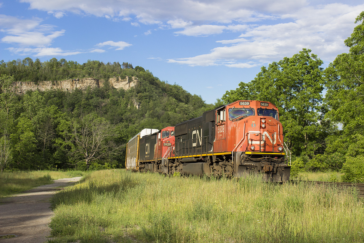
Interesting. Times, they are a changing. I cannot get over the height of the trees on the right. And my favourite ‘fall colour’ tree in the background looks like it has finally up and died. Nature has reclaimed what used to be such a busy area for hikers and wanderers. I guess all the “no parking” signs that have gone up on the side streets haven’t helped.
The tour buses don’t help Arnold. Traffic to the Websters falls area is exponentially higher than it has been in years past..
Nice Kenny. I’ve shot here many times…great location for westbounds.
Tour buses ?? Isn’t the entrance to this area gated and fenced by CN ?? The last time I tried walking the old path, from the parking lot along the creek “gorge” it was littered with overgrowth and fallen limbs.
Again, this location was a hive of activity, legal and otherwise, when I worked there between 1969-1973. Oh if those trees could talk….
If you want to get a sense from 1973 regarding changes, here’s a link to my shot at precisely the same angle ( I suppose you’ll have to copy & paste) -
https://get.google.com/albumarchive/109072816545809910647/album/AF1QipMffddwk6PPD7idp0VOugt5ClBLeRs_7qUcTQel/AF1QipPGMS8LQvfR22sVZdvZp9kiuE4d8Th28-4lz9AJ
Bruce, correct, it’s gated and fenced, but the tour busses that bring people to the ‘main areas’ also contribute to the sheer volumes of people walking all along the various trails in the area.
In October-ish (peak colour) the volume of crowds is just overwhelming. Honestly, there’s probably a few thousand people on the trails at any given time at that time of year, and more than half are tourists… from other countries.
And plenty walk along this portion too and it’s only getting worse and quickly – word’s getting out of the beauty in this area.
I was up on the Peak a year ago on a nice day and at least 50 people joined me. I’ve not been back to the spot since. I was wondering where they all came from……….until I checked the parking lot(s) up top. Now that all the parking areas down below have been signed NO Parking, it has killed this area for wandering choo-choo photographers. Wonder how long it will be before they start spilling over the Peak’s edge, a la Albion?