Welcome Visitor. First time here? Like what you see? Bookmark us for when you are bored, and check out 'top shots' and 'fantastic (editors choice)' in the menu above, you won't be dissapointed. Join our community! click here to sign up for an account today. Sick of this message? Get rid of it by logging-in here.


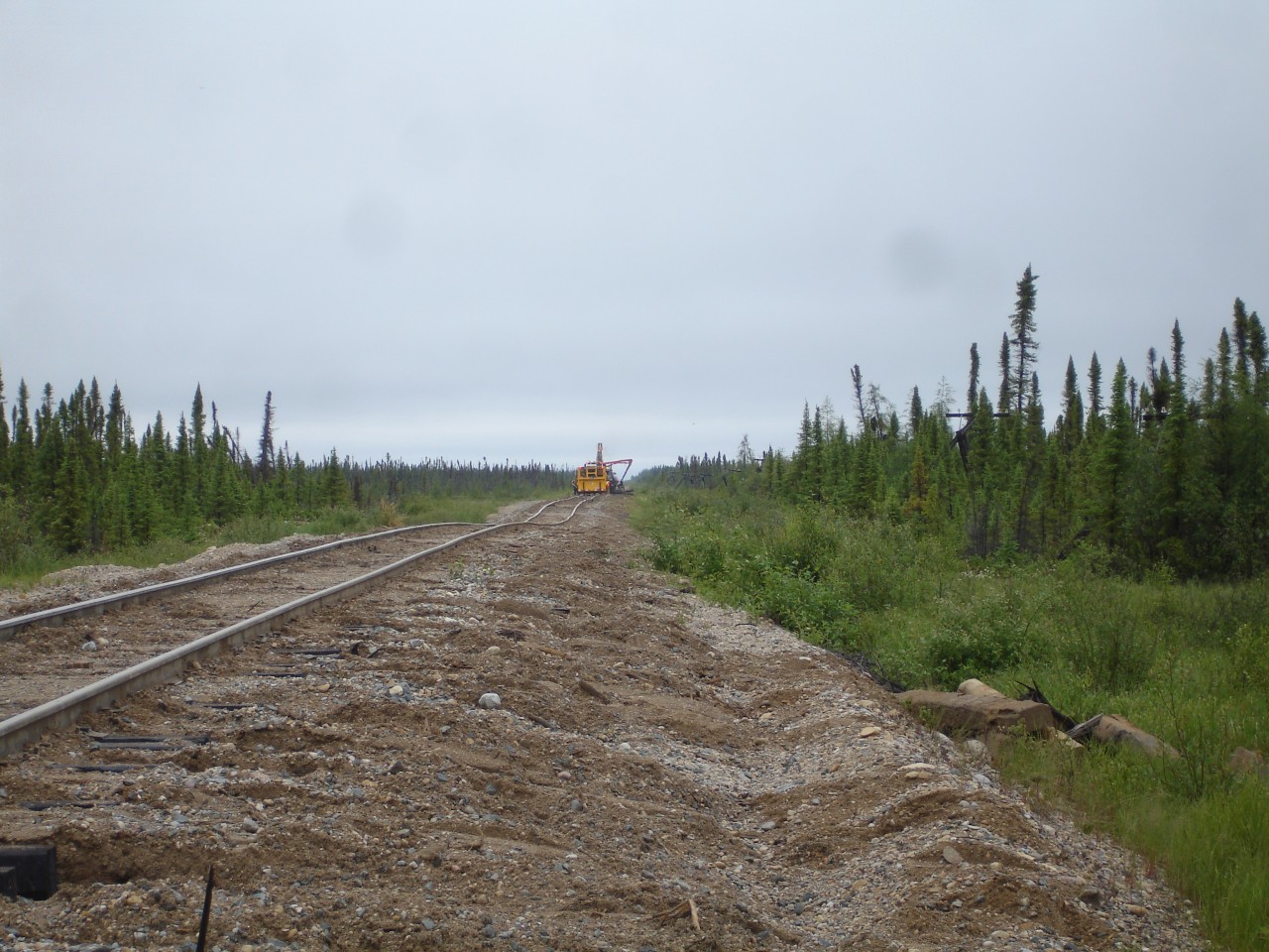
North of Gillam, between Amery and Charlebois, MB, the Hudson Bay Railway main line is not quite as pretty as your normal track structure.  In this pic, crews are working hard to replace ties and tamp track to provide a safer and more comfortable ride for both passengers and cargo alike. The only way in or out of this portion of the line is by rail.  The roads stop just outside of Gillam. The vegetation continues to get shorter, thinner, and more sparse as you get closer to Churchill.  Photo by David Wylie submitted with permission.
Copyright Notice: This image ©David Wylie all rights reserved.


Caption: North of Gillam, between Amery and Charlebois, MB, the Hudson Bay Railway main line is not quite as pretty as your normal track structure. In this pic, crews are working hard to replace ties and tamp track to provide a safer and more comfortable ride for both passengers and cargo alike. The only way in or out of this portion of the line is by rail. The roads stop just outside of Gillam. The vegetation continues to get shorter, thinner, and more sparse as you get closer to Churchill. Photo by David Wylie submitted with permission.

Photographer:
David Wylie [442] (more) (contact)
Date: 07/22/2009 (search)
Railway: Hudson Bay Railway (search)
Reporting Marks: HBRY (search)
Train Symbol: Not Provided
Subdivision/SNS: The Pas to Churchill line (search)
City/Town: Between Amery and Charlebois (search)
Province: Manitoba (search)
Share Link: http://www.railpictures.ca/?attachment_id=6671
Click here to Log-in or Register and add your vote.

6 Favourites
Photographers like Gold.Log-in or Register to show appreciation
View count: 5288 Views

Share this image on Facebook, Twitter or email using the icons below
Photo ID: 5956

Map courtesy of Open Street Map

Full size | Suncalc


All comments must be positive in nature and abide by site rules. Anything else may be removed without warning.

4 Comments
  1. Barren railroading and it’s fascinating.

  2. I heard this line was a turkey trail…. And they weren’t kidding!

  3. Any idea what was at the end of the branch to kischiayamweekemow?

  4. “Any idea what was at the end of the branch to kischiayamweekemow?” – this mystery has been bugging me, but I finally figured it out – it was a mine.
    Confirmed it here:
    http://www4.rncan.gc.ca/search-place-names/unique/GAQCX

Railpictures.ca © 2006-2024 all rights reserved. Photographs are copyright of the photographer and used with permission
Terms and conditions | About us