Profile Page for tlanders1962
This page shows statistics, photos, and an all-time map for tlanders1962. Photographers: Filling your map and earning awards can only be done one way. Submit today!
About tlanders1962
User has not yet set their bio. To set your bio click 'My Profile'.
tlanders1962's Railpictures.ca photo upload statistics
Number of images: 6
Total gold: 48
Number of comments recieved : 9
Number of comments posted : 8
Total views: 12102
Contact tlanders1962
To contact tlanders1962 for licensing, permission, or to send a private comment click this link: (contact)
* note: all inquiries are moderated
tlanders1962's 6 photos on Railpictures.ca:
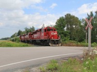
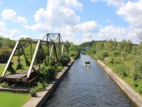
| Name: | Tom Landers |
| Railway: | Canadian Pacific |
| Date: | 08/09/2018 |
| Location: | Bourget |
| Province: |
Ontario |
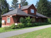
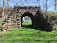
| Name: | Tom Landers |
| Railway: | Canadian National |
| Date: | 08/06/2018 |
| Location: | LakeField |
| Province: |
Ontario |
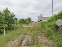
| Name: | Tom Landers |
| Railway: | Ontario Southland |
| Date: | 06/10/2018 |
| Location: | Delhi |
| Province: |
Ontario |
| Name: | Tom Landers |
| Railway: | Canadian Pacific |
| Date: | 08/09/2017 |
| Location: | Havelock |
| Province: |
Ontario |
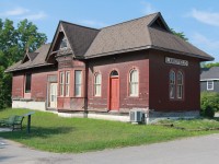
| Name: | Tom Landers |
| Railway: | Canadian National |
| Date: | 08/08/2017 |
| Location: | Nassau Mills |
| Province: |
Ontario |
| Name: | Tom Landers |
| Railway: | Canadian National |
| Date: | 04/23/2017 |
| Location: | St. George |
| Province: |
Ontario |
tlanders1962's Map:
Note: Due to Google's greediness you may have to click the OK button when it asks you if you own this website. We'll replace this in time, but it's going to be a while. Sorry :)
*Note: Only photos with GPS added upon submission are mapped here. Some users do not map images and may show a blank map.