Welcome Visitor. First time here? Like what you see? Bookmark us for when you are bored, and check out 'top shots' and 'fantastic (editors choice)' in the menu above, you won't be dissapointed. Join our community! click here to sign up for an account today. Sick of this message? Get rid of it by logging-in here.


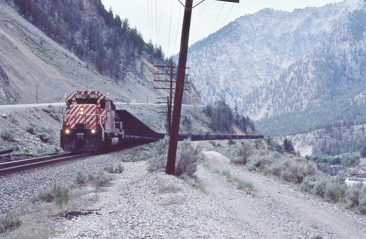
GMD 1974 built SD40-2 with an extra unit coal train (white flags white markers).


    CP Rail 5815 to Progress Rail in 2006.


   What is striking is the single unit, unusual to us Easterners, then of course the West always got the newest, bestest.
 

   Need help on location, direction, etc., Anyone ?


  Somewhere in the Thompson River canyon, May 12, 1980 Kodachrome by S.Danko
Copyright Notice: This image ©sdfourty all rights reserved.


Caption:

GMD 1974 built SD40-2 with an extra unit coal train (white flags white markers).

CP Rail 5815 to Progress Rail in 2006.

What is striking is the single unit, unusual to us Easterners, then of course the West always got the newest, bestest.

Need help on location, direction, etc., Anyone ?

Somewhere in the Thompson River canyon, May 12, 1980 Kodachrome by S.Danko

Photographer:
sdfourty [703] (more) (contact)
Date: 05/12/1980 (search)
Railway: Canadian Pacific (search)
Reporting Marks: CP Rail 5815 (search)
Train Symbol: CP Rail Extra East 5815 (search)
Subdivision/SNS: Thompson (search)
City/Town: Thompson River Valley (search)
Province: British Columbia (search)
Share Link: http://www.railpictures.ca/?attachment_id=52703
Click here to Log-in or Register and add your vote.

12 Favourites
Photographers like Gold.Log-in or Register to show appreciation
View count: 466 Views

Share this image on Facebook, Twitter or email using the icons below
Photo ID: 51398

Sorry, there is no map for this photo. Photographer did not add GPS co-ordinates. Please add next time or ask for a correction to this photo.


All comments must be positive in nature and abide by site rules. Anything else may be removed without warning.

3 Comments
  1. Hi Steve. Been checking this on Google earth. I do believe this photo was taken about 9.5km east of downtown Lytton (as the crow flies). On Google you will see a point called Tank Hill which is the spot that is 9.5km from Lytton. At Tank Hill is a grade crossing with the mainline, I think the photographer is west of the rail crossing and a little ways down the road that you can see on Google. This seems to be the same road as in your photo. Also, there is mountain in the upper right of your picture, if you put yourself on the road in Google, maybe go a little west to get closer, you will see that the tree lines on the Google mountain are very similar to the ones on your mountain photo. Lat and Long 50.255706° -121.450145°. I wouldn’t bet the house, but, I would place a few bucks you were near this rail crossing. :-)

  2. AJ you got the spot. On a trip west in 1981 I have a photo taken a few miles east of this location.

  3. Wow. Thank you for the investigation! And I bet it is all GE power here now.
    sdfourty

Railpictures.ca © 2006-2024 all rights reserved. Photographs are copyright of the photographer and used with permission
Terms and conditions | About us