|
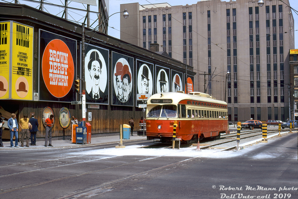
Caption: TTC PCC 4438 (an A7-class streetcar built by CC&F in 1949) works the Dundas route bound for Dundas West Subway Station, westbound on Dundas Street about to cross Yonge Street during some trackwork. Pedestrians, in typical 70's attire, wait for the lights change to cross south, next to the usual Toronto Star, Toronto Sun and Globe & Mail newspaper boxes crowding the streetcar stop. Yonge Street was (and still is) a major transfer point between west-east streetcar routes and the Yonge Subway line, and one can just spot the stairway entrance to Dundas Station visible beside the streetcar.
4438 is passing the old iconic Brown Derby Tavern, which resided at the northeast corner of Yonge and Dundas from 1949 until 1974 (in this view, it appears to have been already closed with the entrance boarded up). The building was renovated and opened again with a row of small streetside restaurants and shops (see a 1976 view here), which lasted into the early 2000's when it was finally demolished for the current 10 Dundas East development. The Ryerson Polytechnical Institute's Victoria Building is visible in the background off of nearby Victoria Street (Ryerson was not yet a university until 1993).
Robert D. McMann photo, Dan Dell'Unto collection slide.
|


Love those old light-up street signs.
There were a few sets of those illuminated signs still in use in the late 2000′s (notably at tne NW corner of Queen & Bay), but I think now they’ve all been replaced. They’ve become collector’s items in the “road geek” hobby. Introduced in the mid-late 60s, a blue background indicated a north-south road, and a yellow background a west-east.
The brown car behind the taxi looks like a Rolls Royce Silver Shadow.